
Trussville ZIP Coverage at a Glance
Only one postal code is conclusively verified by both city and USPS sources for municipal Trussville. Another Birmingham postal code borders the city and is sometimes marketed as Trussville, but the research does not prove that it lies within the corporate boundary. This postal guide therefore marks certainty and uncertainty instead of turning an informal place label into a jurisdiction claim.
| ZIP | Areas Covered | Post Office | Notes |
|---|---|---|---|
| 35173 | Core Trussville and outlying Trussville-addressed parcels | Trussville Post Office | Verified city relationship; not proof of corporate limits or county |
| 35235 | Birmingham postal area adjoining west and southwest Trussville | Not verified as a Trussville station | Do not call it a city ZIP without a parcel check |
The 35173 code is not PO-box-only. The Trussville station offers street delivery, General Delivery, and post-office boxes. No official source verified a Trussville-only unique ZIP, a local ZIP split, a realignment year, or a citywide ZIP population count. Those gaps rule out claims that every address carrying the city name belongs to the city.
Trussville ZIP Code Post Office
The official USPS location record identifies the Trussville Post Office at 810 Watterson Curv, Trussville, AL 35173, with telephone 205-661-0373. That source verifies the station and postal address. It does not draw the incorporated line, decide which county holds a deed, or assign school and police service.
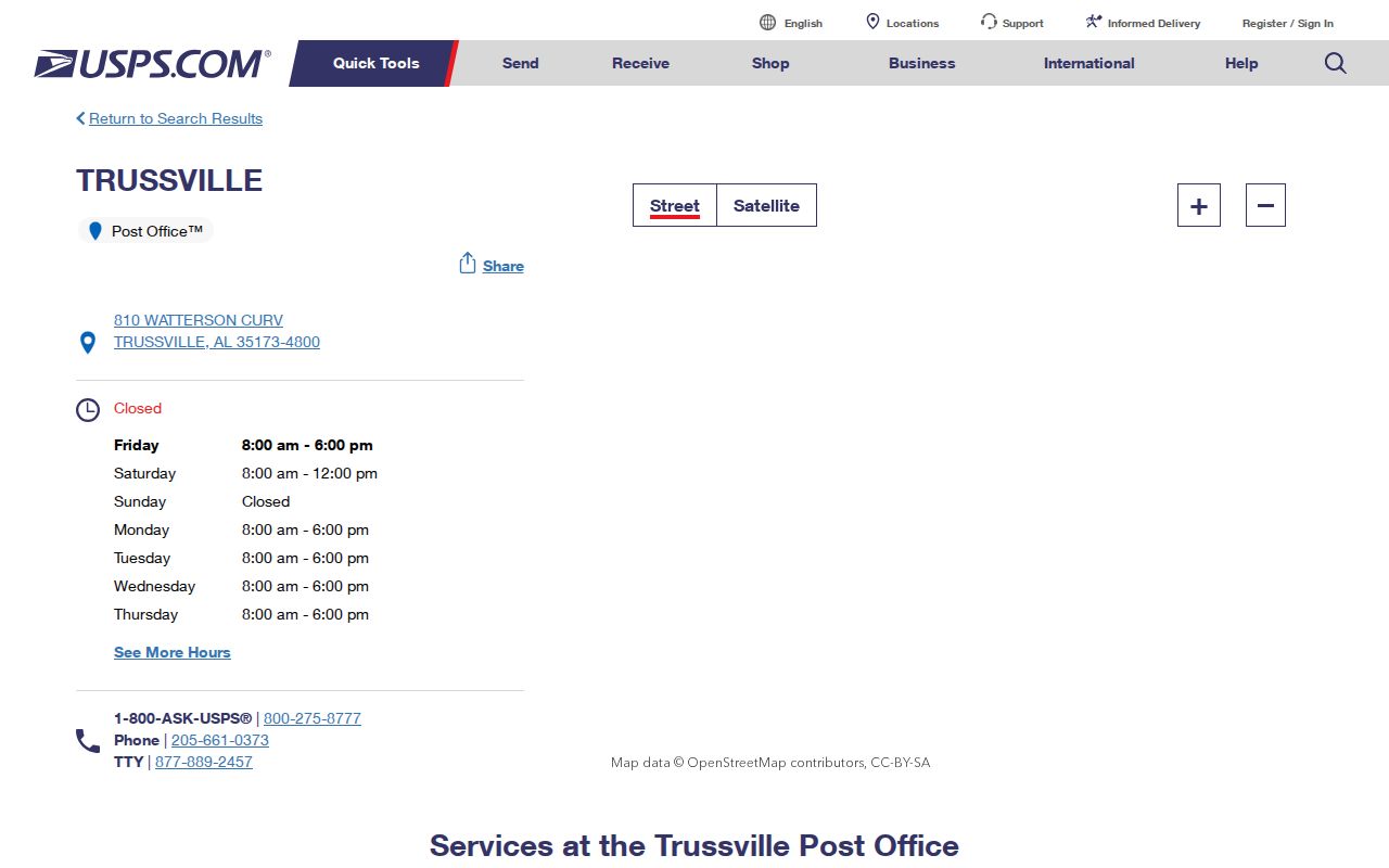
The USPS record supplies the right postal anchor for the Trussville ZIP guide, while parcel viewers supply the separate jurisdiction test.
A ZIP code was built to route mail. It can span municipal borders, unincorporated areas, and more than one records jurisdiction. A post office’s city label likewise does not promise that every delivered parcel is incorporated. Keep the mailing answer and government-boundary answer in separate notes during a search.
Trussville’s 2026 Postal Quirk
Annexation materials from February 24, 2026 provide direct local proof of the mismatch. Properties at 5560, 5574, and 5616 Trussville Clay Road already used Trussville 35173 before their proposed municipal annexation. Mail geography came first. City status required a separate legal process.
An annexation packet requires deed-exact owner names, a complete legal description, and a parcel number. An abbreviated tax-notice description may not be enough. The change becomes effective only after all steps, publication, and Probate filing, not merely after a council vote. The Trussville ordinance archive is the source for these dated annexation records.
Boundary check. Treat “Trussville, AL 35173” as a delivery label until the parcel map and annexation record confirm city and county jurisdiction.
Find Trussville Residents by ZIP
No verified public portal offers a simple, ordinary search that returns every Trussville resident in one ZIP. Jefferson’s CAPture property system stores postal fields, but its documented front-end modes are Name, Parcel Number, and Address. Alabama VoterView is a self-lookup that requires identity facts. The ordered statewide voter file has statutory fields and 2026 use limits, and its legacy request form must be confirmed before relying on old pricing or options.
- Verify the delivery code and standardized address through USPS. Record the mailing city exactly as returned.
- Locate that address in the appropriate parcel viewer. Confirm parcel county, city-limit status, situs, and parcel identifier.
- Choose Jefferson or St. Clair records from the parcel result. Never let the ZIP alone choose the Probate office.
- Move from ZIP geography to a named street or resident only after the jurisdiction check is complete.
Once the postal area narrows to a real street, the Trussville street directory process follows parcels by address. That is more accurate than pretending the Trussville ZIP code directory is a resident roll.
Note: A ZIP can narrow the map, but it cannot prove a person lives at an address or that an owner occupies the parcel.
Trussville ZIPs Cross Record Systems
Most Trussville addresses use Jefferson County’s chain. A portion of incorporated Trussville reaches St. Clair County. Jefferson Parcel Lookup identifies owner, owner-mailing address, situs, parcel identifier, legal description, plat, and value geography. Landmark Web then connects an owner or legal description to recorded instruments. St. Clair’s public parcel service exposes current and previous owner, last deed, sale, and improvement-year fields, but no working public assessment link or deed index was verified.
| Geographic Answer | Best Source | What It Decides |
|---|---|---|
| Postal code | USPS | Mail routing and standard address |
| Parcel county | Jefferson or St. Clair GIS | Assessor and Probate custodian |
| City limits | GIS city-limit layer and filed annexation | Municipal jurisdiction |
| Recorded land | Correct county Probate | Official deed and legal description |
For a St. Clair result, record the PPIN, owner, prior owner, last-deed reference, and sale facts, then contact the St. Clair Probate office to continue. For Jefferson, use Landmark’s Birmingham Division for Trussville. Its index begins in 1987 and images in 1993; older work moves to the record room.
Read Trussville ZIP Address Fields
Property records hold several address forms at once. The situs is the physical parcel address. The owner-mailing address is where tax correspondence goes and may be elsewhere. A legal description identifies land through lot, block, subdivision, plat, or other recorded terms. It remains useful even when the street label changes.
- ZIP and ZIP+4
- A ZIP routes a broad delivery area; ZIP+4 narrows sorting to a smaller delivery segment.
- PO-box ZIP
- A postal code assigned only to boxes. The verified Trussville code is not box-only.
- Unique ZIP
- A code assigned to a single high-volume organization. None was verified for Trussville.
- Carrier route
- A USPS delivery path within a ZIP, not a city boundary or public resident roster.
Jefferson Development Services handles address assignment, the 911 database, GIS, and historical address research in its jurisdiction. It offers a $15 certified verification letter for the unincorporated county and cities within that office’s jurisdiction. The research did not establish that incorporated Trussville delegates every assignment to Jefferson, so owners should call before assuming which office controls a specific number.
Owners working through an address correction should keep site and mailing changes distinct. Jefferson’s guidance calls for stopping use of an old number, posting four-inch reflective numbers, and updating both account or mail records and site or service records. A certified verification letter can support the address fact within the office’s jurisdiction, but it cannot replace a deed’s legal description. For a Trussville ZIP lookup, retain the parcel ID and plat reference while each address system catches up.
Trussville ZIP Geography on the Ground
The historic Cahaba grid gives 35173 a local frame that a five-digit code cannot. The district lies between I-59 and US 11 with the Cahaba River to the east. Brentwood and Rockridge, Poplar, and Parkway form key boundary streets. Poplar, Pine, Oak, Lake, Magnolia, and Magnolia Court run roughly east to west, while Brentwood, Rockridge, Chalkville, and Parkway run roughly north to south.
The central mall is bounded by North, South, East, and West Mall. Original Cahaba Project lots were about one-half to three-quarters of an acre. Later growth followed modern downtown and subdivision or annexation corridors such as Trussville-Clay Road, Deerfoot, Dollar Road, and Vann Valley. These eras explain why postal Trussville includes a varied landscape rather than one neat municipal block.
Citywide Census facts should not be assigned to the ZIP. Trussville recorded 26,123 residents in 2020 and an estimated 27,273 in July 2025, but those municipal figures follow the city boundary rather than the 35173 delivery area. The same caution applies to household, age, income, and owner-occupancy measures. Without a verified ZIP-specific table, label those numbers as Trussville city facts and do not present them as the profile of everyone receiving 35173 mail.
A ZIP code directory can organize that geography, but parcel IDs and plats are the durable bridges when an address, city status, or county assignment is in doubt.
Trussville ZIP and City Limits
The safe rule is simple: never infer city limits from the postal line. The Trussville ZIP code directory can prove that USPS recognizes a mailing location, yet only a parcel and boundary source can place the land inside Trussville. That distinction affects where to ask for deeds, taxes, permits, zoning files, election geography, and police records.
It also protects against overclaiming 35235. That Birmingham ZIP adjoins west and southwest Trussville and may be marketed with a Trussville label, but no official source reviewed for the research proved it lies inside the corporate limits. Check each parcel on its own facts. If a source disagrees, keep the USPS address for mail while using the filed legal description and current boundary layer for government records.
When a map and mailing record still conflict, save the USPS result, parcel identifier, and dated city-limit view. Ask the county or city office to confirm the specific fact it controls. A deed copy can settle the legal land description; an annexation ordinance and Probate filing can settle a boundary change; an address office can explain a site number. None of those records should be stretched into a claim about every property in the ZIP.
The city publishes ordinances and planning records that document annexations over time. The counties maintain parcel geography. USPS maintains delivery geography. A reliable ZIP code lookup uses all three without asking any one system to answer a question outside its purpose.